

Leaflet | OSM Mapnik
Propriétés du produit
Titre:
SPOT 6 XS ORTHO_TOC 2018-08-02 10:40:01Z
Satellite:
SPOT 6
Instrument:
NAOMI6
Mode du Capteur:
XS
Angle d'incidence:
20.3544 °
Temps:
2018-08-02T10:40:01Z
Mode de production:
XS
Niveau de traitement:
ORTHO_TOC
Résolution:
5 m
Système Carto/Géo:
urn:ogc:def:crs:EPSG::2154
Emprise:
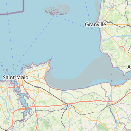
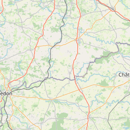
{"coordinates":[[[324200,6782885],[324200,6847575],[392940,6847575],[392940,6782885],[324200,6782885]]],"type":"Polygon"}
Collection:
KALCNES
Identifiant:
2078035585945467
Type:
eo_image
Sous-type:
optical
Publié le:
2020-05-08T13:35:12+02:00
Documentation
Description:
ORTHO_TOC XS image acquired by SPOT 6 on 2018-08-02 at 10:40:01Z
Producteur:
Kalideos
Identifiant du producteur:
SPOT6_NAOMI6_MS_ORTHO_TOC_20180802_104001
| Langue | Nom |
|---|
Annexes:
Liens existants
| Type | Image | Paramètres | |
| PAN<->XS | SPOT 6 PAN ORTHO_TOC 2018-08-02 10:40:01Z | ||
| Stéréo Non Native | SPOT 6 XS ORTHO_TOC 2019-08-27 10:41:35Z | B/H=0.6199 | |
| Stéréo Non Native | SPOT 6 XS ORTHO_TOC 2019-07-11 10:52:09Z | B/H=0.5945 | |
| Stéréo Non Native | SPOT 6 XS ORTHO_TOC 2018-10-05 10:46:57Z | B/H=0.6260 | |
| Stéréo Non Native | SPOT 6 XS ORTHO_TOC 2018-06-23 10:48:36Z | B/H=0.5048 | |
| Stéréo Non Native | SPOT 6 XS ORTHO_TOC 2017-07-06 10:54:44Z | B/H=0.6923 | |
| Stéréo Non Native | SPOT 6 XS ORTHO_TOC 2017-06-17 10:51:03Z | B/H=0.6214 | |
| Stéréo Non Native | SPOT 6 XS ORTHO_TOC 2017-04-21 10:39:19Z | B/H=0.6788 | |
| Stéréo Non Native | SPOT 6 XS ORTHO_TOC 2016-08-16 10:48:50Z | B/H=0.6735 | |
| Stéréo Non Native | SPOT 6 XS ORTHO_TOC 2016-07-16 10:37:33Z | B/H=0.5531 |
Mots clés
Localisation:
Northern
Localisation:
Coastal
Pays:
France (98.74 %)
Région:
Bretagne
Région:
Basse-Normandie
Etat:
Ille-et-Vilaine (80.3 %)
Etat:
Manche (10.43 %)
Etat:
Côtes-d'Armor (7.99 %)
Saison:
Summer
